OBI OBI
Obi Obi varies in altitude/elevation from about 95 m to 480 m above sea level.
The postcode for Obi Obi is 4574.
The Obi Obi Road is a sealed and an unsealed road in Queensland. It goes from near Kenilworth to Mapleton.
The Obi Obi Road’s highest elevation along its length is 424m and the lowest point is at 95.5m.
For cyclists and those towing caravans, boats or heavy loads the Obi Obi Road is mountainous along its 19.3 km length, with about 3 km that is steeper in incline/grade than 5% (1.4 km is steeper in incline/grade than 10% and 830 m of that has an incline/grade more than 15%!). The total ascent / descent along the length of the Obi Obi Road is 300 m / 573 m.
Obi Obi Creek
Obi Obi Creek in southeast Queensland starts at an elevation of 524m and ends at an elevation of 89m flowing into the Mary River.
The Obi Obi Creek drops around 435m over its 53.2km length.
The Obi Obi Creek flows through Lake Baroon (215m) on its way to joining the Mary River.
Above taken from Bonzle – http://www.bonzle.com/c/a
Kidaman Creek
In the Kidaman Creek area, 8km south-east of Kenilworth , some slightly mineralised veins were prospected, but no payable gold was found. Alluvial gold was worked on Walli and Chinaman Creeks in the early 1900’s.
From – Treasurer Enterprises of Australia – http://www.treasureenterprises.com/
Federal Electoral division maps
Map of the Division of Fairfax
Click to access 2009-aec-map-qld-fairfax.pdf
Map of the Division of Fisher
Click to access 2009-aec-map-qld-fisher.pdf
.
Qld State Electoral division maps
Map of the division of Nicklin
Map of the division of Glasshouse
For an interactive map
http://ecq.clients.squiz.net/electoral-boundaries/find-my-electorate/state-district-maps
.
Sunshine Coast Council Divisional Maps
See the links below to download profiles and divisional map for divisions 5 and 10
https://www.sunshinecoast.qld.gov.au/Council/Mayor-and-Councillors/Councillor-Profiles
Local divisional map
Council interactive map of the entire shire
Shows titles, contours and has an aerial map.
https://scrc.maps.arcgis.com/apps/webappviewer/index.html?id=106efc5dea924725b5044037b0444e80
.
Queensland Property Boundaries – Digital Cadastral Database (DNRM)
.
Kenilworth and area history
Origin of name
The town, on the Mary River, is named after the cattle run taken up by Richard Smith. Mrs Smith was reading Scott’s novel “Kenilworth” at the time the run was tendered for, hence the name “Kenilworth”.
The Mary River, known to the Aboriginal people as Numabulla was firstly called by the explorers by its Aboriginal name, then referred to as Wide Bay River, and officially named the “Mary” after Governor Fitzroy’s wife, in 1847.
Early history of settlement
Early explorers who passed through the area included Dr Simpson and Ludwig Leichhardt, and several sheep farmers. In 1850, Richard Smith selected the Kenilworth cattle run of 16,000 acres on the east bank of the Mary River. In 1858, it was consolidated with other runs, North Kenilworth, Cambroon and Cordalba and sold.
The effects of the 1884 Land Act finally reached the Kenilworth area in 1888, when land on the old grazing properties was surveyed and made available for selection. Farm sizes in this area ranged between 160 and 640 acres. News of the availability of reasonably priced land attracted Richard Sims, Jack Ginn and Edward Pickering. They investigated the Kenilworth area in 1889 and applied for land. They were met by Christopher Sharry who had settled there about two months previously. Further legislation encouraged dairying and agriculture and more settlers arrived in Kenilworth. Frederick and Albert Goeths, the three Hornibrook brothers, William and Henry Hilder, the Liekefett family, Jacob and Harry Fritz and their families, and the Pearce family had all arrived by 1898.
Settlers in the Kenilworth and Belli areas developed a varied economy in the early period. Most grew maize and vegetables; Fred Goeths supplemented his income by making fruit cases for farmers near Mapleton, and his brother Albert sold timber from his property and drove the mail coach on the Kenilworth-Eumundi run. More and more dairy cattle were brought to the Kenilworth area in the early years of 1900. Richard Sims bought a manual cream separator, which was installed on his farm in 1898. Seven suppliers brought their milk to the separator and in July 1898 the first Kenilworth cream was taken to the railway station at Eumundi to be sent to Brisbane. J.C. Hassall, manager of Mt Ubi station, bought a steam separator in 1899, which helped to boost production.
The industry grew steadily despite disruptions during the 1898 flood and the 1902 drought. The Kenilworth Farmers Association decided in 1905 that a cooperative butter factory should be established in the region to provide an accessible market for their cream. The Caboolture Co-operative Company developed from this initiative. Cream was transported to Eumundi railway station and forwarded by rail to the Caboolture factory, which opened in 1907, and later to the Eumundi Butter Factory, which opened in 1920.
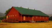
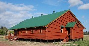
In the early 1920s, the remaining large sections of Kenilworth and Mt Ubi cattle stations were cut up into smaller blocks and auctioned for dairy farms. The town of Kenilworth was surveyed on part of the old Kenilworth Station in 1921. In 1923, T.H. Gordon began a motor bus service, and in 1924 a new hall and community centre was built. The Provisional School began on 21 October, 1924. Arthur E. Tanner opened the first general store on 2 January, 1924. In the same year, Mr Harry Fritz Jr opened a Butcher shop.
The influx of people to take up new farms made Kenilworth one of the big growth areas in the Maroochy shire during the 1920s. The population of the Kenilworth district doubled from 500 in 1915 to 1000 in 1930.
Taken from Sunshine Coast Council’s heritage webpage
https://heritage.sunshinecoast.qld.gov.au/Places/Town-Histories/Kenilworth
https://heritage.sunshinecoast.qld.gov.au/About/Media-Releases/Backward-Glance-and-the-history-of-Conondale-030517
https://heritage.sunshinecoast.qld.gov.au/About/Media-Releases/Backward-Glance-Mapleton-beginnings-Part-2-171018
.
Closer Settlement in the Kenilworth District
.